
1952 Map of Cordova B-3
USGS Topo · Published 1965About this map
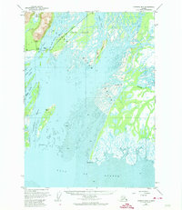
The Copper River dominates this coastal landscape as it empties into the Gulf of Alaska, creating an intricate network of shifting channels and islands within the Chugach National Forest. The complex Martin River Delta is visible to the east, where the Martin River meets tidal flats and extensive mud banks. This area is characterized by a series of braided waterways including Healy Island Slough, Storey Slough, and the Kokinhenik Branch, illustrating the dynamic nature of glacial runoff and sediment deposition.
Find a feature on this map
22 named features on this map. Tap any name to fly to it.
Don’t see what you’re looking for? This feature index may not catch every label — zoom into the map to look around manually.
Map Details
Editions of this 1952 Cordova B-3 Map
3 editions found
Other maps of this area

1948 · Cordova
USGS Topo · 1:250,000

1950 · Cordova B-2
USGS Topo · 1:63,360

1950 · Cordova A-2
USGS Topo · 1:63,360

1950 · Cordova C-4
USGS Topo · 1:63,360

1951 · Cordova
USGS Topo · 1:250,000

1951 · Cordova B-4
USGS Topo · 1:63,360

1951 · Cordova C-3
USGS Topo · 1:63,360

1953 · Cordova A-2
USGS Topo · 1:63,360

1953 · Cordova C-3
USGS Topo · 1:63,360

1953 · Cordova C-4
USGS Topo · 1:63,360