
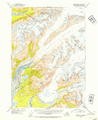
1953 Map of Cordova C-4
USGS Topo · Published 1954About this map
Scott Glacier and Sheridan Glacier dominate this landscape within the Chugach National Forest, showcasing a complex glacial system at the mid-century. The map meticulously documents the extensive networks of crevasses and the drainage patterns of the Rude River and Glacier River. Topographic detail is derived from 1950 aerial photography, providing a precise record of ice movement and mountain terrain before significant modern climate shifts. Notable signs of human presence include radio towers near the coast and a solitary cabin near Bear Lake, suggesting a period of light utility and seasonal habitation in this corner of Alaska's Third Judicial Division.
Find a feature on this map
16 named features on this map. Tap any name to fly to it.
Don’t see what you’re looking for? This feature index may not catch every label — zoom into the map to look around manually.
Map Details
Editions of this 1953 Cordova C-4 Map
2 editions found
Other maps of this area

1948 · Cordova
USGS Topo · 1:250,000

1950 · Cordova C-4
USGS Topo · 1:63,360

1950 · Cordova D-3
USGS Topo · 1:63,360

1950 · Cordova D-5
USGS Topo · 1:63,360

1951 · Cordova
USGS Topo · 1:250,000

1951 · Cordova B-4
USGS Topo · 1:63,360

1951 · Cordova C-5
USGS Topo · 1:63,360

1951 · Cordova B-5
USGS Topo · 1:63,360

1951 · Cordova C-3
USGS Topo · 1:63,360

1951 · Cordova D-4
USGS Topo · 1:63,360