
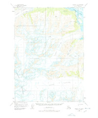
1950 Map of Cordova D-3
USGS Topo · Published 1965About this map
Glacial ice dominates this mid-century survey of the Chugach Mountains, where the massive Allen Glacier and Heney Glacier carve through the high terrain. In the northeast corner, the Copper River flows past the site of Bremner (Aban'd), a location reflecting the transient nature of settlement in this demanding landscape.
Find a feature on this map
14 named features on this map. Tap any name to fly to it.
Don’t see what you’re looking for? This feature index may not catch every label — zoom into the map to look around manually.
Map Details
Editions of this 1950 Cordova D-3 Map
2 editions found
Other maps of this area

1948 · Cordova
USGS Topo · 1:250,000

1950 · Valdez A-3
USGS Topo · 1:63,360

1950 · Cordova C-4
USGS Topo · 1:63,360

1951 · Cordova
USGS Topo · 1:250,000

1951 · Cordova C-3
USGS Topo · 1:63,360

1951 · Cordova D-4
USGS Topo · 1:63,360

1951 · Valdez A-2
USGS Topo · 1:63,360

1952 · Valdez
USGS Topo · 1:250,000

1953 · Cordova D-4
USGS Topo · 1:63,360

1953 · Cordova C-3
USGS Topo · 1:63,360