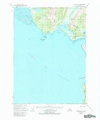
1950 Map of Cordova A-2
USGS Topo · Published 1984About this map
Katalla sits at the center of this 1950 survey, marking a significant site in the early industrial history of the Alaska coast. The map identifies the Katalla Oil Field and a Refinery, representing the first major petroleum development in the territory. While these facilities and the nearby settlement of Redwood are noted as abandoned or inactive by mid-century, their locations remains clearly defined along the Katalla River and Katalia Slough.
Find a feature on this map
36 named features on this map. Tap any name to fly to it.
Don’t see what you’re looking for? This feature index may not catch every label — zoom into the map to look around manually.
Map Details
Editions of this 1950 Cordova A-2 Map
4 editions found
Other maps of this area

1948 · Cordova
USGS Topo · 1:250,000

1948 · Middleton Island
USGS Topo · 1:250,000

1950 · Middleton Island
USGS Topo · 1:250,000

1950 · Cordova B-2
USGS Topo · 1:63,360

1950 · Cordova A-1
USGS Topo · 1:63,360

1950 · Cordova A-2
USGS Topo · 1:63,360

1951 · Cordova
USGS Topo · 1:250,000

1951 · Cordova B-1
USGS Topo · 1:63,360

1952 · Cordova B-3
USGS Topo · 1:63,360

1953 · Cordova A-2
USGS Topo · 1:63,360