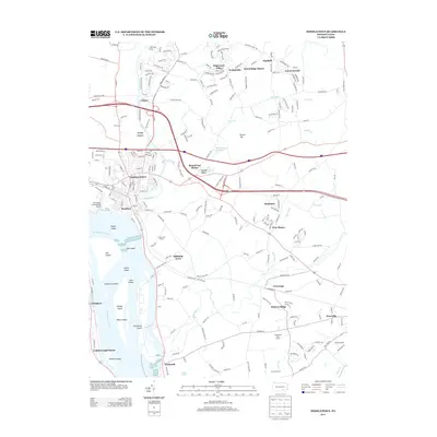
2013 Map of Middletown
USGS Topo · Published 2013About this map
Middletown and Royalton anchor this central Pennsylvania corridor along the Susquehanna River, where dense island chains and major infrastructure converge. The landscape is defined by the heavy footprint of the Harrisburg International Airport and a sprawling network of residential developments like Edgewood Hills, Braeburn, and Pine Manor. Further south, the map details the large footprint of the Masonic Homes near the convergence of Snitz Cr and Conoy Cr.
Find a feature on this map
244 named features on this map. Tap any name to fly to it.
Don’t see what you’re looking for? This feature index may not catch every label — zoom into the map to look around manually.
Map Details
Editions of this 2013 Middletown Map
This is the sole edition of this map. No revisions or reprints were ever made.
Other maps of this area

1892 · Hummelstown
USGS Topo · 1:62,500

1892 · Harrisburg
USGS Topo · 1:62,500

1899 · Harrisburg
USGS Topo · 1:62,500

1906 · New Cumberland
USGS Topo · 1:62,500

1908 · Middletown
USGS Topo · 1:62,500

1924 · Hummelstown
USGS Topo · 1:62,500

1924 · Harrisburg
USGS Topo · 1:62,500

1943 · New Cumberland
USGS Topo · 1:62,500

1943 · Middletown
USGS Topo · 1:62,500

1943 · Harrisburg
USGS Topo · 1:62,500