2023 Map of Middletown
USGS Topo · Published 2023About this map
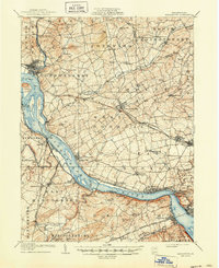
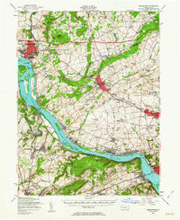
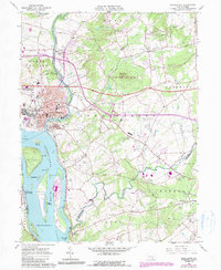
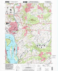
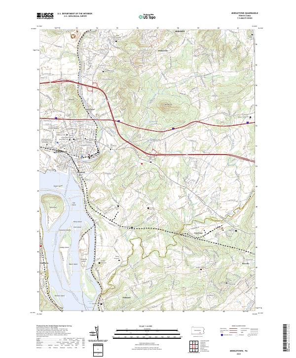
Middletown and Royalton occupy a prominent position at the confluence of the Susquehanna River and Swatara Creek, where the local landscape is defined by its deep industrial and institutional heritage. This survey details an area rich in genealogical landmarks, ranging from the Old German Lutheran Burial Grounds and Saint Peter's Cem to more private family locations like the Gingrich Family Plot. The presence of the Odd Fellows Home and the Pennsylvania State University Harrisburg campus highlights the community's growth north of the river. Moving south toward Falmouth and the Conewago Falls, the map illustrates a transition into more rural terrain punctuated by the Middletown Reservoir and the distinctive elevation of Round Top. The river itself is a complex network of named landforms, including Threemile Island and Shelley Island, documenting the vital water-and-rail infrastructure that has long sustained the Dauphin County region.
Find a feature on this map
60 named features on this map. Tap any name to fly to it.
Don’t see what you’re looking for? This feature index may not catch every label — zoom into the map to look around manually.
Map Details
Editions of this 2023 Middletown Map
This is the sole edition of this map. No revisions or reprints were ever made.
Historical Maps of Falmouth Through Time
6 maps found