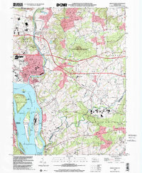
1999 Map of Middletown
USGS Topo · Published 2001About this map
The Susquehanna River dominates the western edge of this landscape, its wide channel punctuated by a chain of major islands including Hill Island, Shelley Island, and Three Mile Island, where the Three Mile Island Nuclear Generating Station stands as a prominent industrial landmark. At the confluence of the river and Swatara Creek, the borough of Middletown serves as a dense urban hub, supported by the Conrail line and the adjacent Harrisburg International Airport.
Find a feature on this map
48 named features on this map. Tap any name to fly to it.
Don’t see what you’re looking for? This feature index may not catch every label — zoom into the map to look around manually.
Map Details
Editions of this 1999 Middletown Map
This is the sole edition of this map. No revisions or reprints were ever made.
Other maps of this area

1892 · Hummelstown
USGS Topo · 1:62,500

1892 · Harrisburg
USGS Topo · 1:62,500

1899 · Harrisburg
USGS Topo · 1:62,500

1906 · New Cumberland
USGS Topo · 1:62,500

1908 · Middletown
USGS Topo · 1:62,500

1924 · Hummelstown
USGS Topo · 1:62,500

1924 · Harrisburg
USGS Topo · 1:62,500

1943 · New Cumberland
USGS Topo · 1:62,500

1943 · Middletown
USGS Topo · 1:62,500

1943 · Harrisburg
USGS Topo · 1:62,500