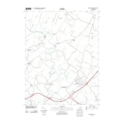
2010 Map of Middletown
USGS Topo · Published 2010About this map
Cedar Creek winds through the heart of the Shenandoah Valley on this 2010 survey, serving as a geographic anchor for the Cedar Creek Battlefield and various historic settlements. The town of Middletown stands as a focal point, supported by the Middletown Post Office and nearby Mount Carmel Cemetery. The landscape is a complex network of agriculture and history, evidenced by Rinker Orchards near Ridings Hill and the presence of Stephens Fort to the northwest. Local family and community roots are deeply legible through numerous burial grounds, including the Quaker Cemetery and Stickley Cemetery. Geographic features like Little North Mountain, Pangletown Ridge, and Baldwin Gap define the western horizon, while several runs such as Buffalo Marsh Run and Zanes Run drain the fertile valley floor toward the main creek.
Find a feature on this map
94 named features on this map. Tap any name to fly to it.
Don’t see what you’re looking for? This feature index may not catch every label — zoom into the map to look around manually.
Map Details
Editions of this 2010 Middletown Map
This is the sole edition of this map. No revisions or reprints were ever made.
Other maps of this area

1893 · Luray
USGS Topo · 1:125,000

1894 · Winchester
USGS Topo · 1:125,000

1905 · Luray
USGS Topo · 1:125,000

1923 · Middletown
USGS Topo · 1:62,500

1937 · Middletown
USGS Topo · 1:48,000

1938 · Winchester
USGS Topo · 1:48,000

1939 · Front Royal
USGS Topo · 1:48,000

1942 · Winchester
USGS Topo · 1:62,500

1943 · Middletown
USGS Topo · 1:62,500

1944 · Front Royal
USGS Topo · 1:62,500