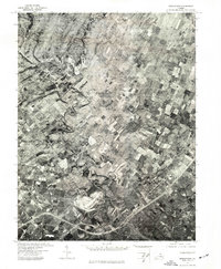
1972 Map of Middletown
USGS Topo · Published 1977About this map
Middletown and the surrounding Shenandoah Valley landscape appear in striking detail in this 1972 orthophotograph. This specialized survey by the Geological Survey and Commonwealth of Virginia uses aerial imagery to show the actual footprint of farms, woodlots, and road networks as they existed in the early 1970s. The winding course of Cedar Creek carves a deep path through the terrain, serving as a prominent geographical marker between Lebanon Church and the more concentrated residential and commercial blocks of the town. This orthophoto provides a precise visual record of land use and development patterns, capturing the density of the settlement and the expansive agricultural fields that define the region's character during this era.
Find a feature on this map
3 named features on this map. Tap any name to fly to it.
Don’t see what you’re looking for? This feature index may not catch every label — zoom into the map to look around manually.
Map Details
Editions of this 1972 Middletown Map
This is the sole edition of this map. No revisions or reprints were ever made.
Other maps of this area

1893 · Luray
USGS Topo · 1:125,000

1894 · Winchester
USGS Topo · 1:125,000

1905 · Luray
USGS Topo · 1:125,000

1923 · Middletown
USGS Topo · 1:62,500

1937 · Middletown
USGS Topo · 1:48,000

1938 · Winchester
USGS Topo · 1:48,000

1939 · Front Royal
USGS Topo · 1:48,000

1942 · Winchester
USGS Topo · 1:62,500

1943 · Middletown
USGS Topo · 1:62,500

1944 · Front Royal
USGS Topo · 1:62,500