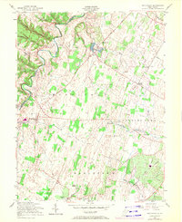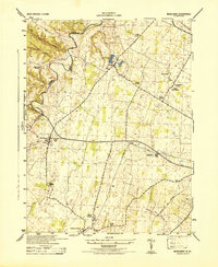
1944 Map of Middleway
USGS Topo · Published 1944About this map
Opequon Creek meanders along the border of Berkeley and Jefferson Counties in this 1944 survey, anchoring a landscape defined by small agrarian settlements and the local extraction industry. The village of Middleway serves as a central hub, while the presence of the U S Fish Hatchery near Leetown indicates the federal investment in the region's natural resources during the mid-20th century. Further east, the Stone Quarry and Limestone Quarry underscore the importance of the local geology to the area's economy.
Find a feature on this map
26 named features on this map. Tap any name to fly to it.
Don’t see what you’re looking for? This feature index may not catch every label — zoom into the map to look around manually.
Map Details
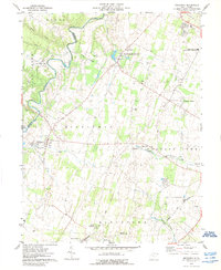
Editions of this 1944 Middleway Map
This is the sole edition of this map. No revisions or reprints were ever made.
Historical Maps of Charles Town Through Time
8 maps found