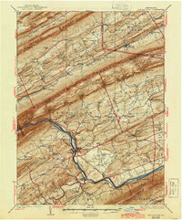
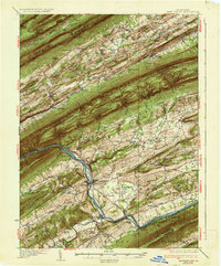
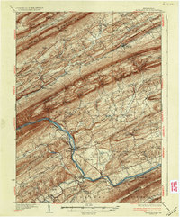
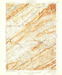
1937 Map of Mifflintown
USGS Topo · Published 1944About this map
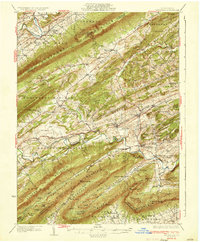
Mifflintown sits as a vital river crossing along the Juniata River, where the Pennsylvania RR and the Wm Penn Highway trace the water's edge through the water gaps of Central Pennsylvania. This mid-1930s landscape is defined by the sharp, parallel ridges of Jacks Mountain, Mahantango Mountain, and Shade Mountain, which separate fertile agricultural pockets like Lost Creek Valley and Pleasant Valley. These valleys are dotted with a dense network of country schoolhouses such as Whitehall Sch and Reno Sch, alongside long-established settlements including McAlisterville and McClure.
Find a feature on this map
133 named features on this map. Tap any name to fly to it.
Don’t see what you’re looking for? This feature index may not catch every label — zoom into the map to look around manually.
Map Details
Editions of this 1937 Mifflintown Map
3 editions found
Other maps of this area

1907 · New Bloomfield
USGS Topo · 1:62,500

1907 · Millerstown
USGS Topo · 1:62,500

1919 · Mattawana
USGS Topo · 1:62,500

1924 · Centre Hall
USGS Topo · 1:62,500

1924 · Lewistown
USGS Topo · 1:62,500

1925 · Mifflintown
USGS Topo · 1:48,000

1927 · Lewisburg
USGS Topo · 1:62,500
1929 · Centre Hall
USGS Topo · 1:62,500

1930 · Loysville
USGS Topo · 1:62,500
1933 · Loysville
USGS Topo · 1:62,500