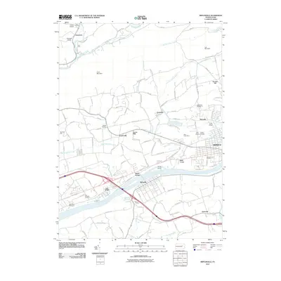
2010 Map of Mifflinville
USGS Topo · Published 2010About this map
The Susquehanna River cuts a wide path through this portion of Columbia County, anchoring a landscape defined by riverside settlements and narrow mountain ridges. The village of Mifflinville sits on the southern bank, connected by bridges to Willow Springs and the outskirts of Berwick. To the north, the terrain rises sharply toward Knob Mountain and Lee Mountain, where numerous small runs and creeks like Fishing Creek and Huntington Creek carve out hollows such as Creasy Hollow and Geisinger Hollow.
Find a feature on this map
99 named features on this map. Tap any name to fly to it.
Don’t see what you’re looking for? This feature index may not catch every label — zoom into the map to look around manually.
Map Details
Editions of this 2010 Mifflinville Map
This is the sole edition of this map. No revisions or reprints were ever made.
Other maps of this area

1889 · Catawissa
USGS Topo · 1:62,500

1892 · Catawissa
USGS Topo · 1:62,500

1892 · Mahanoy
USGS Topo · 1:62,500

1893 · Mahanoy
USGS Topo · 1:62,500

1894 · Catawissa
USGS Topo · 1:62,500

1894 · Shickshinny
USGS Topo · 1:62,500

1894 · Bloomsburg
USGS Topo · 1:62,500

1946 · Shickshinny
USGS Topo · 1:31,680

1946 · Berwick
USGS Topo · 1:31,680

1947 · Bloomsburg
USGS Topo · 1:24,000
Featured Places
- Berwick, PA
- North Centre Township, PA
- Briar Creek, PA
- Main Township, PA
- Pealertown, Fishing Creek Township