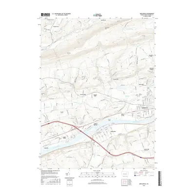
2016 Map of Mifflinville
USGS Topo · Published 2016About this map
The Susquehanna River carves a wide path through this portion of Columbia County, serving as the historical and geographic anchor for settlements like Berwick, Mifflinville, and Almedia. The river's influence is seen in the placement of French Island and the proximity of the rail and road corridors that follow its banks. Further north, the landscape transitions into the steep ridges of Huntington Mtn and Knob Mtn, separated by the drainage of Huntington Creek. This area is characterized by smaller crossroads and hillside hamlets such as Jonestown, Evansville, and Fowlersville.
Find a feature on this map
188 named features on this map. Tap any name to fly to it.
Don’t see what you’re looking for? This feature index may not catch every label — zoom into the map to look around manually.
Map Details
Editions of this 2016 Mifflinville Map
This is the sole edition of this map. No revisions or reprints were ever made.
Other maps of this area

1889 · Catawissa
USGS Topo · 1:62,500

1892 · Catawissa
USGS Topo · 1:62,500

1892 · Mahanoy
USGS Topo · 1:62,500

1893 · Mahanoy
USGS Topo · 1:62,500

1894 · Catawissa
USGS Topo · 1:62,500

1894 · Shickshinny
USGS Topo · 1:62,500

1894 · Bloomsburg
USGS Topo · 1:62,500

1946 · Shickshinny
USGS Topo · 1:31,680

1946 · Berwick
USGS Topo · 1:31,680

1947 · Bloomsburg
USGS Topo · 1:24,000
Featured Places
- Berwick, PA
- North Centre Township, PA
- Briar Creek, PA
- Main Township, PA
- Pealertown, Fishing Creek Township