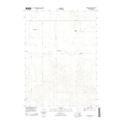
2014 Map of Mignery Ranch
USGS Topo · Published 2014About this map
Mignery Ranch and several other significant agricultural holdings anchor this Wheeler County landscape, where the meandering course of Beaver Cr provides a central water source for the region's ranching operations. The terrain is marked by the distinctive undulating topography of the Sandhills, characterized by numerous small depressions and rises that dictate the placement of ranch houses and rural roads. Large-scale land use is evident in the naming of properties like Stokes Ranch, Koinzan Ranch, and Day Ranch, highlighting a pattern of consolidated land ownership typical of central Nebraska. A grid of section-line roads, including Derner Ranch Ave and Stone House Ave, facilitates movement across this specialized grazing country, while Ne-70 provides the primary east-west arterial connection through the northern section of the survey area.
Find a feature on this map
15 named features on this map. Tap any name to fly to it.
Don’t see what you’re looking for? This feature index may not catch every label — zoom into the map to look around manually.
Map Details
Editions of this 2014 Mignery Ranch Map
This is the sole edition of this map. No revisions or reprints were ever made.
Other maps of this area

1954 · Bartlett SE
USGS Topo · 1:24,000

1954 · Bartlett
USGS Topo · 1:24,000

1955 · Broken Bow
USGS Topo · 1:250,000

1955 · O'Neill
USGS Topo · 1:250,000

1956 · Broken Bow
USGS Topo · 1:250,000

1959 · O'Neill
USGS Topo · 1:250,000

1960 · Spalding 2 SW
USGS Topo · 1:24,000

1960 · Spalding 2 NW
USGS Topo · 1:24,000

1960 · Spalding 2 NE
USGS Topo · 1:24,000

1960 · Spalding 2 SE
USGS Topo · 1:24,000