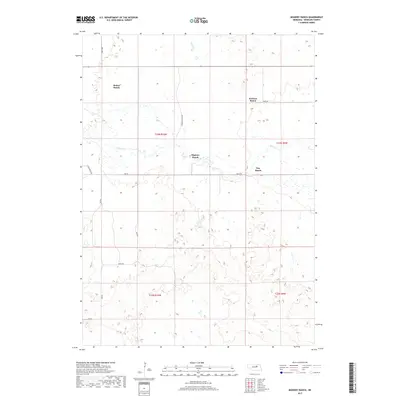
2017 Map of Mignery Ranch
USGS Topo · Published 2017About this map
Mignery Ranch and several other family-named landholdings define the rural character of this Wheeler County landscape during the early 21st century. The terrain is marked by the meandering path of Beaver Cr, which flows eastward through the central portion of the quadrangle. Significant ranching operations including Stokes Ranch, Koinzan Ranch, and Day Ranch are connected by a network of secondary roads such as Stone House Ave and Derner Ranch Ave. The map illustrates a sparse, working landscape organized by the Public Land Survey System, with township boundaries like t23n r10w and t23n r9w providing the structural grid for these vast Nebraska holdings. The presence of specialized local routes, including Swine Rd, points to the region's specific agricultural and livestock-focused economy.
Find a feature on this map
19 named features on this map. Tap any name to fly to it.
Don’t see what you’re looking for? This feature index may not catch every label — zoom into the map to look around manually.
Map Details
Editions of this 2017 Mignery Ranch Map
This is the sole edition of this map. No revisions or reprints were ever made.
Other maps of this area

1954 · Bartlett SE
USGS Topo · 1:24,000

1954 · Bartlett
USGS Topo · 1:24,000

1955 · Broken Bow
USGS Topo · 1:250,000

1955 · O'Neill
USGS Topo · 1:250,000

1956 · Broken Bow
USGS Topo · 1:250,000

1959 · O'Neill
USGS Topo · 1:250,000

1960 · Spalding 2 SW
USGS Topo · 1:24,000

1960 · Spalding 2 NW
USGS Topo · 1:24,000

1960 · Spalding 2 NE
USGS Topo · 1:24,000

1960 · Spalding 2 SE
USGS Topo · 1:24,000