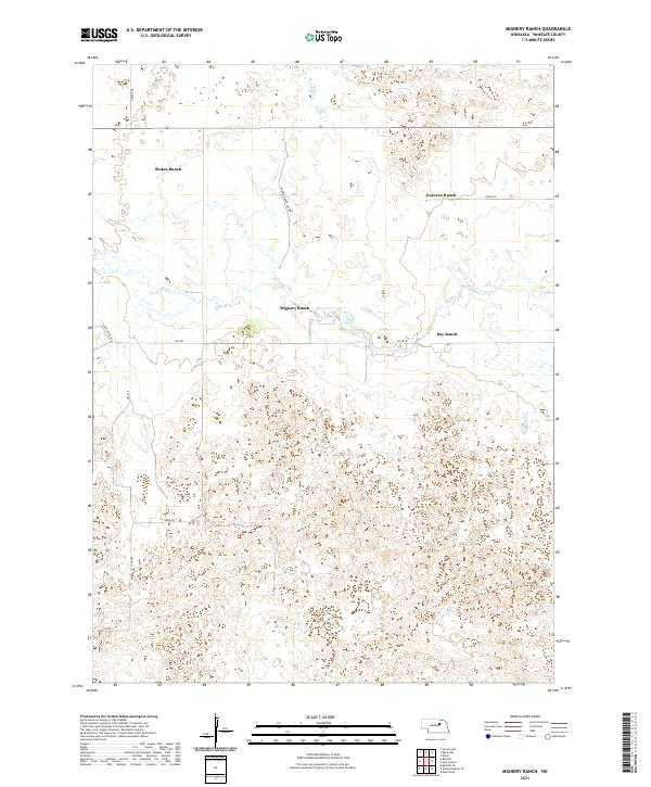
2021 Map of Mignery Ranch
USGS Topo · Published 2021About this map
Mignery Ranch and several other family-named landholdings define this portion of Wheeler County, characterizing the ranching landscape of central Nebraska. The terrain is marked by the passage of Beaver Cr, which meanders through the northern sections near Stokes Ranch and Day Ranch. The map illustrates a sparse but deliberate network of section-line roads and named thoroughfares, such as Derner Ranch Ave and Stone House Ave, which provide access across the township divisions of T23N and T22N. This 2021 survey reflects the enduring spatial organization of the Sandhills region, where large ranching operations like Koinzan Ranch remain the primary centers of activity. Small local connectors like Swine Rd and 832 Rd hint at specific agricultural uses and livestock management within these expansive properties.
Find a feature on this map
19 named features on this map. Tap any name to fly to it.
Don’t see what you’re looking for? This feature index may not catch every label — zoom into the map to look around manually.
Map Details
Editions of this 2021 Mignery Ranch Map
This is the sole edition of this map. No revisions or reprints were ever made.
Other maps of this area

1954 · Bartlett SE
USGS Topo · 1:24,000

1954 · Bartlett
USGS Topo · 1:24,000

1955 · Broken Bow
USGS Topo · 1:250,000

1955 · O'Neill
USGS Topo · 1:250,000

1956 · Broken Bow
USGS Topo · 1:250,000

1959 · O'Neill
USGS Topo · 1:250,000

1960 · Spalding 2 SW
USGS Topo · 1:24,000

1960 · Spalding 2 NW
USGS Topo · 1:24,000

1960 · Spalding 2 NE
USGS Topo · 1:24,000

1960 · Spalding 2 SE
USGS Topo · 1:24,000