
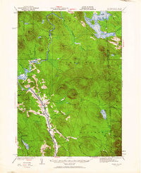
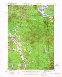
1930 Map of Milan
USGS Topo · Published 1952About this map
The Androscoggin River carves a deep valley through this northern New Hampshire landscape, serving as the primary corridor for transportation and settlement in the early 1930s. Along its banks, the Grand Trunk railroad follows the water's path, connecting the village of Milan with northern outposts. The rural character of the area is underscored by a network of one-room schoolhouses scattered across the hills, including Jewett Sch, Willis Sch, and Milan Hill Sch.
Find a feature on this map
94 named features on this map. Tap any name to fly to it.
Don’t see what you’re looking for? This feature index may not catch every label — zoom into the map to look around manually.
Map Details
Editions of this 1930 Milan Map
3 editions found
Other maps of this area

1893 · Mt. Washington
USGS Topo · 1:62,500

1893 · Gorham
USGS Topo · 1:62,500

1896 · Mt. Washington
USGS Topo · 1:62,500

1896 · Gorham
USGS Topo · 1:62,500

1914 · Bethel
USGS Topo · 1:62,500

1930 · Percy
USGS Topo · 1:62,500

1930 · Dixville
USGS Topo · 1:62,500

1930 · Errol
USGS Topo · 1:62,500

1933 · Dixville
USGS Topo · 1:62,500

1933 · Milan
USGS Topo · 1:62,500