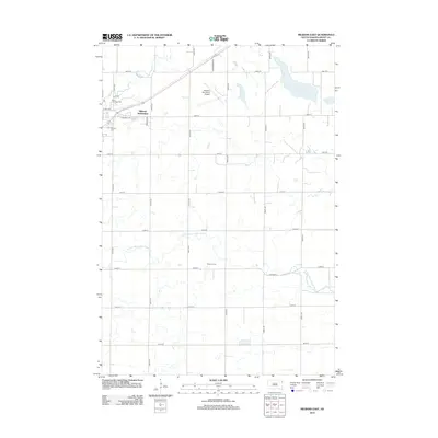
2012 Map of Milbank East
USGS Topo · Published 2012About this map
Lake Albert and the meandering course of the N Fork Yellow Bank River define the rural landscape east of the Milbank city center. In this eastern portion of Grant County, the map captures the transition from residential growth to agricultural expanses. Notable for genealogists and local historians are the Milbank Cem and Saint Lawrence Cem, located near the intersection of N St NE and 479th Ave. The area is characterized by a precise grid of section roads, including 148th St and Schumacher Rd, which service the Milbank Municipal Airport and smaller residential pockets like the Milbank Subdivision. Further south, the map documents the Victory Farms area and the rural transport network along Co Hwy 14.
Find a feature on this map
27 named features on this map. Tap any name to fly to it.
Don’t see what you’re looking for? This feature index may not catch every label — zoom into the map to look around manually.
Map Details
Editions of this 2012 Milbank East Map
This is the sole edition of this map. No revisions or reprints were ever made.
Other maps of this area

1953 · Ortonville
USGS Topo · 1:62,500

1953 · Bellingham
USGS Topo · 1:62,500

1953 · Milbank
USGS Topo · 1:250,000

1954 · Big Stone Lake
USGS Topo · 1:62,500

1958 · Milbank
USGS Topo · 1:250,000

1971 · Marietta
USGS Topo · 1:24,000

1971 · Rosen
USGS Topo · 1:24,000

1971 · Big Stone Lake SE
USGS Topo · 1:24,000

1971 · Big Stone Lake SW
USGS Topo · 1:24,000
1971 · Ortonville
USGS Topo · 1:24,000