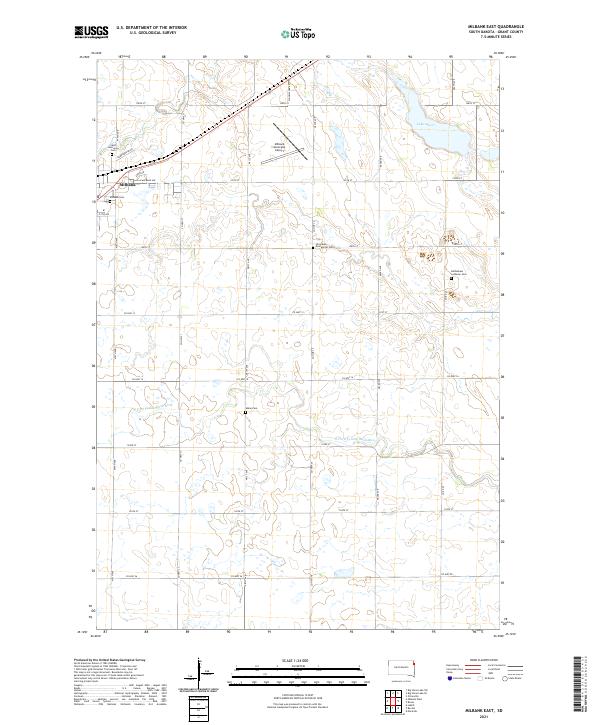
2021 Map of Milbank East
USGS Topo · Published 2021About this map
Milbank and its eastern surroundings are characterized by the organized grid of Grant County section lines and the winding path of the N Fork Yellow Bank River. This landscape reflects a deep history of rural settlement, preserved through a notable concentration of community burial grounds. Local genealogists will find several distinct sites including the Saint Lawrence Cem, Milbank Cem, and the Bethlehem Lutheran Cem to the east. The terrain is marked by numerous small depressions and prairie potholes, typical of the regional geography, with Lake Albert serving as a significant water feature in the northeast corner. Modern infrastructure is represented by the Milbank Municipal Airport and a network of well-defined county roads such as Co Hwy 12 and Co Hwy 31 that facilitate movement across the agricultural plains.
Find a feature on this map
38 named features on this map. Tap any name to fly to it.
Don’t see what you’re looking for? This feature index may not catch every label — zoom into the map to look around manually.
Map Details
Editions of this 2021 Milbank East Map
This is the sole edition of this map. No revisions or reprints were ever made.
Other maps of this area

1953 · Ortonville
USGS Topo · 1:62,500

1953 · Bellingham
USGS Topo · 1:62,500

1953 · Milbank
USGS Topo · 1:250,000

1954 · Big Stone Lake
USGS Topo · 1:62,500

1958 · Milbank
USGS Topo · 1:250,000

1971 · Marietta
USGS Topo · 1:24,000

1971 · Rosen
USGS Topo · 1:24,000

1971 · Big Stone Lake SE
USGS Topo · 1:24,000

1971 · Big Stone Lake SW
USGS Topo · 1:24,000
1971 · Ortonville
USGS Topo · 1:24,000