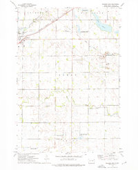
1973 Map of Milbank East
USGS Topo · Published 1976About this map
The town of Milbank anchors this eastern South Dakota landscape, shown here as a regional hub for rail transport and resource extraction. The Chicago Milwaukee St Paul and Pacific railroad cuts through the northern townships of Melrose and Big Stone, following the course of the Whetstone River. The area's granite industry is clearly visible through a series of quarries and gravel pits concentrated in Alban township.
Find a feature on this map
24 named features on this map. Tap any name to fly to it.
Don’t see what you’re looking for? This feature index may not catch every label — zoom into the map to look around manually.
Map Details
Editions of this 1973 Milbank East Map
This is the sole edition of this map. No revisions or reprints were ever made.
Other maps of this area

1953 · Ortonville
USGS Topo · 1:62,500

1953 · Bellingham
USGS Topo · 1:62,500

1953 · Milbank
USGS Topo · 1:250,000

1954 · Big Stone Lake
USGS Topo · 1:62,500

1958 · Milbank
USGS Topo · 1:250,000

1971 · Marietta
USGS Topo · 1:24,000

1971 · Rosen
USGS Topo · 1:24,000

1971 · Big Stone Lake SE
USGS Topo · 1:24,000

1971 · Big Stone Lake SW
USGS Topo · 1:24,000
1971 · Ortonville
USGS Topo · 1:24,000