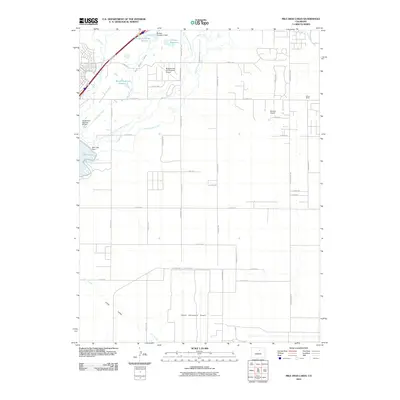
2010 Map of Mile High Lakes
USGS Topo · Published 2010About this map
Denver International Airport dominates the southern landscape of this Colorado quadrangle, illustrating the massive scale of 21st-century infrastructure on the High Plains. To the north, the terrain transitions into a complex irrigation network essential for agriculture in Grass Valley. A dense system of waterways including the Denver-Hudson Canal, Neres Canal, and Burlington Extension Ditch feeds several local water bodies.
Find a feature on this map
44 named features on this map. Tap any name to fly to it.
Don’t see what you’re looking for? This feature index may not catch every label — zoom into the map to look around manually.
Map Details
Editions of this 2010 Mile High Lakes Map
This is the sole edition of this map. No revisions or reprints were ever made.
Other maps of this area

1890 · East Denver
USGS Topo · 1:125,000

1902 · Greeley
USGS Topo · 1:125,000

1938 · Long Branch
USGS Topo · 1:24,000

1940 · Brighton
USGS Topo · 1:31,680

1941 · Long Branch
USGS Topo · 1:31,680

1942 · Mile High Lakes
USGS Topo · 1:31,680

1942 · Box Elder School
USGS Topo · 1:31,680

1944 · Brighton
USGS Topo · 1:31,680
1948 · Long Branch
USGS Topo · 1:24,000

1949 · Fort Lupton
USGS Topo · 1:24,000