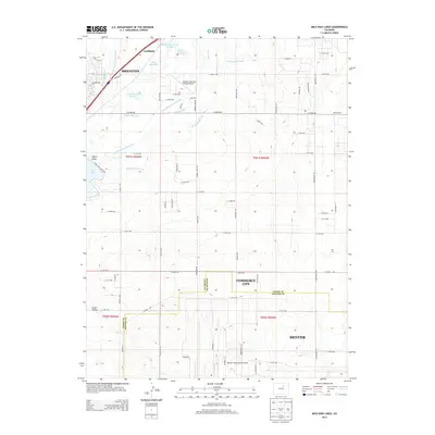
2013 Map of Mile High Lakes
USGS Topo · Published 2013About this map
Lochbuie and the edge of Brighton anchor the northern reaches of this High Plains landscape, where an intricate network of irrigation systems sustains the region's agriculture. The Denver-Hudson Canal, Beebe-Seep Canal, and Neres Canal weave through the terrain, feeding water to local landmarks like Mile High Lakes and Calhoun Reservoir. This interplay of water management and land use is a defining characteristic of the area, supporting established operations such as the Patton Ranch and the residential Brighton Van-Aire Estates Airport.
Find a feature on this map
77 named features on this map. Tap any name to fly to it.
Don’t see what you’re looking for? This feature index may not catch every label — zoom into the map to look around manually.
Map Details
Editions of this 2013 Mile High Lakes Map
This is the sole edition of this map. No revisions or reprints were ever made.
Other maps of this area

1890 · East Denver
USGS Topo · 1:125,000

1902 · Greeley
USGS Topo · 1:125,000

1938 · Long Branch
USGS Topo · 1:24,000

1940 · Brighton
USGS Topo · 1:31,680

1941 · Long Branch
USGS Topo · 1:31,680

1942 · Mile High Lakes
USGS Topo · 1:31,680

1942 · Box Elder School
USGS Topo · 1:31,680

1944 · Brighton
USGS Topo · 1:31,680
1948 · Long Branch
USGS Topo · 1:24,000

1949 · Fort Lupton
USGS Topo · 1:24,000