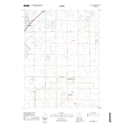
2019 Map of Mile High Lakes
USGS Topo · Published 2019About this map
Brighton and Lochbuie anchor the northern reaches of this High Plains landscape, where the transition from agricultural roots to modern suburban and industrial expansion is clearly visible. The region is defined by an intricate network of irrigation infrastructure, including the Denver-Hudson Canal, Beebe Seep Canal, and the W Burlington Extension Ditch, which historically sustained the area's farming economy. Significant water bodies such as Barr Lake and Meeks Reservoir Number 2 break the flat expanse of Grass Valley, while local aviation history is represented by the Van Aire Airport and the sprawling northern boundary of Denver International Airport. This document captures the complex boundary where Adams and Denver counties meet, showing how modern transit corridors like Frontage Road and the Bromley Park Trail have integrated with older canal routes and rural section lines.
Find a feature on this map
83 named features on this map. Tap any name to fly to it.
Don’t see what you’re looking for? This feature index may not catch every label — zoom into the map to look around manually.
Map Details
Editions of this 2019 Mile High Lakes Map
This is the sole edition of this map. No revisions or reprints were ever made.
Other maps of this area

1890 · East Denver
USGS Topo · 1:125,000

1902 · Greeley
USGS Topo · 1:125,000

1938 · Long Branch
USGS Topo · 1:24,000

1940 · Brighton
USGS Topo · 1:31,680

1941 · Long Branch
USGS Topo · 1:31,680

1942 · Mile High Lakes
USGS Topo · 1:31,680

1942 · Box Elder School
USGS Topo · 1:31,680

1944 · Brighton
USGS Topo · 1:31,680
1948 · Long Branch
USGS Topo · 1:24,000

1949 · Fort Lupton
USGS Topo · 1:24,000