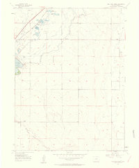
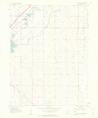
1957 Map of Mile High Lakes
USGS Topo · Published 1958About this map
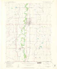
Mile High Lakes and the expansive Barr Lake anchor this 1950s landscape of the High Plains, where agricultural development and water management define the terrain. The northern portion of the quadrangle is dominated by a complex system of irrigation reservoirs and canals, including Bowles Reservoir No 2, Calhoun Reservoir, and Meeks Res No 1. These features, alongside the Burlington Chicago and Quincy railroad line, illustrate the critical infrastructure required for settlement in this semi-arid region.
Find a feature on this map
12 named features on this map. Tap any name to fly to it.
Don’t see what you’re looking for? This feature index may not catch every label — zoom into the map to look around manually.
Map Details
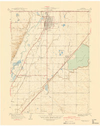
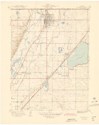
Editions of this 1957 Mile High Lakes Map
2 editions found
Other maps of this area

1890 · East Denver
USGS Topo · 1:125,000

1902 · Greeley
USGS Topo · 1:125,000

1938 · Long Branch
USGS Topo · 1:24,000
1940 · Brighton
USGS Topo · 1:31,680

1941 · Long Branch
USGS Topo · 1:31,680

1942 · Mile High Lakes
USGS Topo · 1:31,680

1942 · Box Elder School
USGS Topo · 1:31,680
1944 · Brighton
USGS Topo · 1:31,680

1948 · Long Branch
USGS Topo · 1:24,000
1949 · Fort Lupton
USGS Topo · 1:24,000