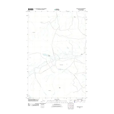
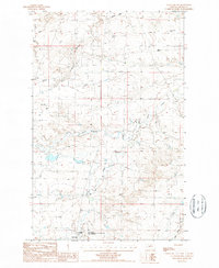
2011 Map of Miles Butte
USGS Topo · Published 2011About this map
Peoples Creek meanders through this portion of Blaine County, serving as the central drainage for a landscape defined by isolated summits and water management features. Prominent landforms such as Miles Butte, Iron Butte, and McCann Butte rise above the surrounding terrain, while the northern reaches show a series of small-scale impoundments including Yukon Jack Dam and the curiously named Yuletide Dam. The importance of water conservation in this arid ranching environment is evident in the naming of local landmarks like Kuhr Number 2 Dam and the Kuhr Coulee. Access through this open country is maintained by a handful of primary routes, most notably Peoples Creek Rd and Barney Olson Rd, which link the various drainages and seasonal creek beds like Maggie Creek and O'Bryan Creek.
Find a feature on this map
13 named features on this map. Tap any name to fly to it.
Don’t see what you’re looking for? This feature index may not catch every label — zoom into the map to look around manually.
Map Details
Editions of this 2011 Miles Butte Map
This is the sole edition of this map. No revisions or reprints were ever made.
Other maps of this area

1953 · Havre
USGS Topo · 1:250,000

1956 · Rattlesnake
USGS Topo · 1:62,500

1956 · Cleveland
USGS Topo · 1:62,500

1957 · Havre
USGS Topo · 1:250,000

1958 · Havre
USGS Topo · 1:250,000
1964 · Big Coulee
USGS Topo · 1:24,000

1971 · Putnam Lake
USGS Topo · 1:24,000
1971 · Newhouse Reservoir
USGS Topo · 1:24,000
1984 · Dodson
USGS Topo · 1:100,000
1987 · Cleveland NW
USGS Topo · 1:24,000