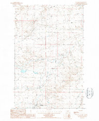
1987 Map of Cleveland NW
USGS Topo · Published 1987About this map
Chief Joseph Battleground of the Bears Paw State Monument occupies the southern reach of this landscape, marking the site of the Nez Perce’s 1877 surrender. The map documents several Historical Monuments and a Picnic Area within this significant cultural site, situated near the headwaters of Snake Creek.
Find a feature on this map
13 named features on this map. Tap any name to fly to it.
Don’t see what you’re looking for? This feature index may not catch every label — zoom into the map to look around manually.
Map Details
Editions of this 1987 Cleveland NW Map
This is the sole edition of this map. No revisions or reprints were ever made.
Other maps of this area

1904 · Yantic
USGS Topo · 1:62,500

1904 · Chinook
USGS Topo · 1:62,500

1912 · Zurich
USGS Topo · 1:125,000

1953 · Havre
USGS Topo · 1:250,000

1956 · Lloyd
USGS Topo · 1:62,500

1956 · Cleveland
USGS Topo · 1:62,500

1957 · Havre
USGS Topo · 1:250,000

1958 · Havre
USGS Topo · 1:250,000
1964 · Lohman SE
USGS Topo · 1:24,000
1964 · Chinook
USGS Topo · 1:24,000