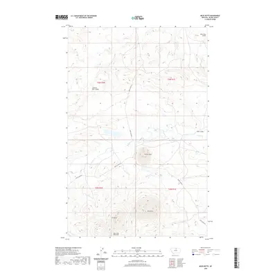
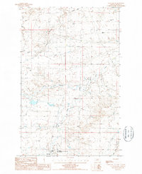
2020 Map of Miles Butte
USGS Topo · Published 2020About this map
Miles Butte and McCann Butte dominate this northern Montana landscape, marking the rugged high ground of the Bears Paw Mountains in southern Blaine County. The map details a drainage network defined by the winding Peoples Cr, which is fed by numerous seasonal waterways including Maggie Cr and O'Bryan Cr. This area is characterized by its high-altitude cattle ranching and open range land, where modern transportation relies on traditional routes like Barney Olson Rd and Peoples Creek Rd. Local topography is further articulated through several distinct coulees such as Little Box Elder Coulee and Kuhr Coulee, reflecting a landscape sculpted by long-term erosion. For those researching the history of the Montana plains, this survey provides a clear view of the natural landmarks and remote access roads that define this section of the state.
Find a feature on this map
17 named features on this map. Tap any name to fly to it.
Don’t see what you’re looking for? This feature index may not catch every label — zoom into the map to look around manually.
Map Details
Editions of this 2020 Miles Butte Map
This is the sole edition of this map. No revisions or reprints were ever made.
Other maps of this area

1953 · Havre
USGS Topo · 1:250,000

1956 · Rattlesnake
USGS Topo · 1:62,500

1956 · Cleveland
USGS Topo · 1:62,500

1957 · Havre
USGS Topo · 1:250,000

1958 · Havre
USGS Topo · 1:250,000
1964 · Big Coulee
USGS Topo · 1:24,000

1971 · Putnam Lake
USGS Topo · 1:24,000
1971 · Newhouse Reservoir
USGS Topo · 1:24,000
1984 · Dodson
USGS Topo · 1:100,000
1987 · Cleveland NW
USGS Topo · 1:24,000