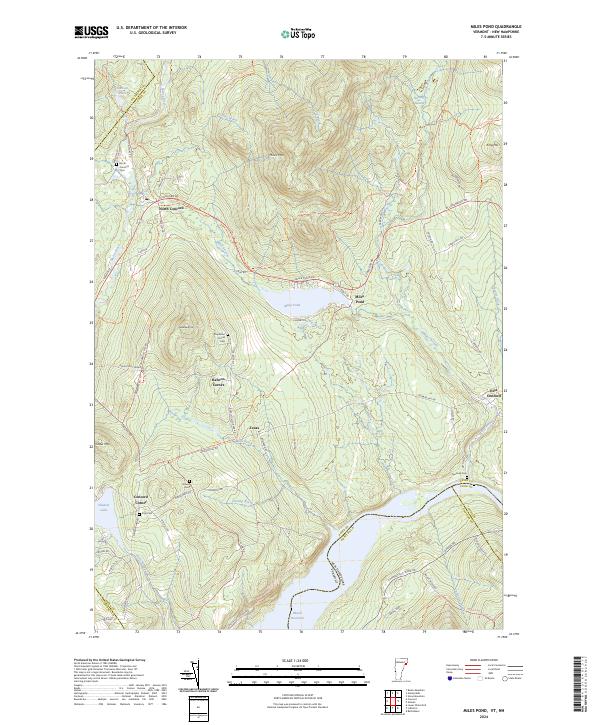
2024 Map of Miles Pond
USGS Topo · Published 2024About this map
The Moose River and Miles Stream define the drainage patterns of this Vermont-New Hampshire borderland, where the Moore Reservoir anchors the southern landscape. The map highlights a series of small, interconnected settlements like North Concord, East Concord, and Texas, connected by a network of historic roads and trails. For those researching local families, several small burial grounds are documented, including the North Concord Cem and the Graves Cem near Concord Corner.
Find a feature on this map
86 named features on this map. Tap any name to fly to it.
Don’t see what you’re looking for? This feature index may not catch every label — zoom into the map to look around manually.
Map Details
Editions of this 2024 Miles Pond Map
This is the sole edition of this map. No revisions or reprints were ever made.
Other maps of this area

1900 · Whitefield
USGS Topo · 1:62,500

1920 · Guildhall
USGS Topo · 1:62,500

1931 · Guildhall
USGS Topo · 1:48,000

1931 · Littleton
USGS Topo · 1:62,500

1932 · Littleton
USGS Topo · 1:48,000

1933 · Guildhall
USGS Topo · 1:48,000

1935 · Littleton
USGS Topo · 1:62,500

1935 · Whitefield
USGS Topo · 1:48,000

1937 · Guildhall
USGS Topo · 1:62,500

1938 · Whitefield
USGS Topo · 1:62,500