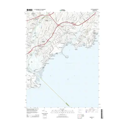
2015 Map of Milford
USGS Topo · Published 2015About this map
The Housatonic River meets Long Island Sound along this coastal stretch of Connecticut, where the modern landscape of Milford and Stratford is defined by a dense network of suburban development and historical transit corridors. The Metro-North railroad and major highways like I-95 and Us-1 cut across the terrain, linking historic centers like Naugatuck Junction and Devon. To the south, the shoreline is a succession of established beach communities, from Lordship Beach in the west to Silver Beach and Woodmont in the east.
Find a feature on this map
96 named features on this map. Tap any name to fly to it.
Don’t see what you’re looking for? This feature index may not catch every label — zoom into the map to look around manually.
Map Details
Editions of this 2015 Milford Map
This is the sole edition of this map. No revisions or reprints were ever made.
Other maps of this area

1889 · Derby
USGS Topo · 1:62,500

1891 · Bridgeport
USGS Topo · 1:62,500

1891 · Derby
USGS Topo · 1:62,500

1892 · New Haven
USGS Topo · 1:62,500

1893 · Bridgeport
USGS Topo · 1:62,500

1893 · Derby
USGS Topo · 1:62,500

1920 · Bridgeport
USGS Topo · 1:62,500

1921 · New Haven
USGS Topo · 1:62,500

1943 · New Haven
USGS Topo · 1:31,680
1947 · Long Hill
USGS Topo · 1:31,680