
2018 Map of Milford
USGS Topo · Published 2018About this map
Charles Island sits just off the coast of Silver Beach, accessible only at low tide across a natural tombolo, anchoring a shoreline defined by recreational beaches and historic coastal settlements. In the city of Milford, the Wepawaug River flows south through the center of town, passing Memorial Bridge and the Milford Cem before reaching Milford Harbor. This modern topographic study shows the densely developed residential corridors of Milford Lawns, Woodmont, and Bayview, as well as the transition from the Housatonic River wetlands to the industrial and aviation hubs near the Igor I Sikorsky Memorial Airport. The map details the intricate hydrography of the region, from the Beaver Brook Ponds and Milford Reservoir to the numerous swamps like Mohawk Swamp and Billberry Swamp that once dictated the path of early road and rail construction.
Find a feature on this map
103 named features on this map. Tap any name to fly to it.
Don’t see what you’re looking for? This feature index may not catch every label — zoom into the map to look around manually.
Map Details
Editions of this 2018 Milford Map
This is the sole edition of this map. No revisions or reprints were ever made.
Other maps of this area

1889 · Derby
USGS Topo · 1:62,500

1891 · Bridgeport
USGS Topo · 1:62,500

1891 · Derby
USGS Topo · 1:62,500

1892 · New Haven
USGS Topo · 1:62,500

1893 · Bridgeport
USGS Topo · 1:62,500

1893 · Derby
USGS Topo · 1:62,500

1920 · Bridgeport
USGS Topo · 1:62,500

1921 · New Haven
USGS Topo · 1:62,500

1943 · New Haven
USGS Topo · 1:31,680
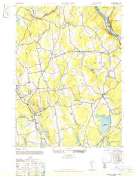
1947 · Long Hill
USGS Topo · 1:31,680