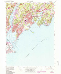
1984 Map of Milford
USGS Topo · Published 1984About this map
Milford and Stratford dominate this mid-1980s coastal survey, where the Housatonic River meets the Long Island Sound. The map reveals an intricate network of shorefront communities, including Myrtle Beach, Walnut Beach, and Lordship, alongside historic landmarks like Fort Trumbull. The landscape is a mix of tidal marshes like Mohawk Swamp and intensive infrastructure, from the Igor Sikorsky Memorial Airport to the sweeping paths of the Merritt Parkway and the Connecticut Turnpike.
Find a feature on this map
99 named features on this map. Tap any name to fly to it.
Don’t see what you’re looking for? This feature index may not catch every label — zoom into the map to look around manually.
Map Details
Editions of this 1984 Milford Map
This is the sole edition of this map. No revisions or reprints were ever made.
Other maps of this area

1889 · Derby
USGS Topo · 1:62,500

1891 · Bridgeport
USGS Topo · 1:62,500

1891 · Derby
USGS Topo · 1:62,500

1892 · New Haven
USGS Topo · 1:62,500

1893 · Bridgeport
USGS Topo · 1:62,500

1893 · Derby
USGS Topo · 1:62,500

1920 · Bridgeport
USGS Topo · 1:62,500

1921 · New Haven
USGS Topo · 1:62,500

1943 · New Haven
USGS Topo · 1:31,680
1947 · Long Hill
USGS Topo · 1:31,680