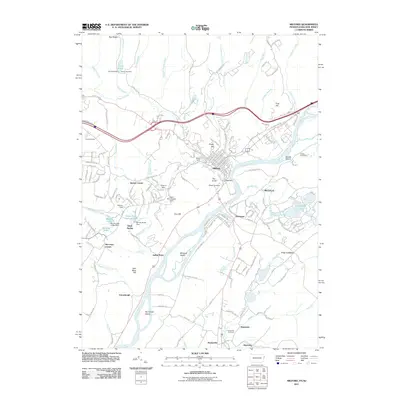
2011 Map of Milford
USGS Topo · Published 2011About this map
The Delaware River serves as the focal point for this borderland geography, where Pennsylvania, New Jersey, and New York converge. This survey highlights the complex hydrology of the river basin, featuring several river islands like Minisink Island and Namanock Island, alongside numerous dams such as the Lily Pond Dam, Rowe Dam, and Richartz Dam. The landscape is dotted with small crossroads settlements, including Montague, Quinns Corner, and Hainesville, which maintain a distinct rural character even as modern infrastructure like the Eureka Stone Quarry and various residential developments expand across the terrain.
Find a feature on this map
175 named features on this map. Tap any name to fly to it.
Don’t see what you’re looking for? This feature index may not catch every label — zoom into the map to look around manually.
Map Details
Editions of this 2011 Milford Map
This is the sole edition of this map. No revisions or reprints were ever made.
Other maps of this area

1888 · Franklin
USGS Topo · 1:62,500

1891 · Wallpack
USGS Topo · 1:62,500

1893 · Wallpack
USGS Topo · 1:62,500

1894 · Franklin
USGS Topo · 1:62,500

1897 · Franklin
USGS Topo · 1:62,500

1903 · Franklin Furnace
USGS Topo · 1:62,500

1906 · Port Jervis
USGS Topo · 1:62,500

1908 · Port Jervis
USGS Topo · 1:62,500

1913 · Milford
USGS Topo · 1:62,500

1915 · Milford
USGS Topo · 1:62,500
Featured Places
- Montague Township, NJ
- Westfall Township, PA
- Milford Township, PA
- Dingman Township, PA
- Silver Spring, Dingman Township