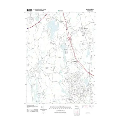
2012 Map of Milford
USGS Topo · Published 2012About this map
The Rockwell Draper Mill Complex in Hopedale serves as a reminder of the industrial legacy along the Mill River. This area is defined by a dense network of water bodies, from the large Whitehall Reservoir in the north near Woodville to the smaller Louisa Lake and Milford Pond that buffer the urban center of Milford. The landscape is punctuated by numerous family-named peaks and ridges, including Peppercorn Hill, Silver Hill, and the Rocky Woods Range.
Find a feature on this map
278 named features on this map. Tap any name to fly to it.
Don’t see what you’re looking for? This feature index may not catch every label — zoom into the map to look around manually.
Map Details
Editions of this 2012 Milford Map
This is the sole edition of this map. No revisions or reprints were ever made.
Other maps of this area

1886 · Blackstone
USGS Topo · 1:62,500

1886 · Framingham
USGS Topo · 1:62,500

1887 · Franklin
USGS Topo · 1:62,500

1887 · Marlboro
USGS Topo · 1:62,500

1889 · Marlboro
USGS Topo · 1:62,500

1889 · Blackstone
USGS Topo · 1:62,500

1889 · Franklin
USGS Topo · 1:62,500

1889 · Framingham
USGS Topo · 1:62,500

1893 · Franklin
USGS Topo · 1:62,500

1893 · Blackstone
USGS Topo · 1:62,500