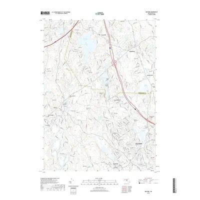
2018 Map of Milford
USGS Topo · Published 2018About this map
Milford and its surrounding Worcester County townships are defined by a complex landscape of glacial hills and an extensive network of small waterways. The headwaters of the Charles River and the Mill River drain a series of significant water bodies, including Whitehall Reservoir in the north and Milford Pond near the town center. The map reveals the dense settlement patterns of the 21st century, where residential growth has expanded around traditional centers like Hopkinton, Upton, and Hopedale. Distinctive topographic features such as Saddle Hill, Peppercorn Hill, and the Rocky Woods Range punctuate the landscape between these communities. For local historians and genealogists, the map provides precise locations for numerous burial grounds, including the Old First Cem and Saint Marys Cem, alongside landmarks like College Rock and Woody Island.
Find a feature on this map
266 named features on this map. Tap any name to fly to it.
Don’t see what you’re looking for? This feature index may not catch every label — zoom into the map to look around manually.
Map Details
Editions of this 2018 Milford Map
This is the sole edition of this map. No revisions or reprints were ever made.
Other maps of this area

1886 · Blackstone
USGS Topo · 1:62,500

1886 · Framingham
USGS Topo · 1:62,500

1887 · Franklin
USGS Topo · 1:62,500

1887 · Marlboro
USGS Topo · 1:62,500

1889 · Marlboro
USGS Topo · 1:62,500

1889 · Blackstone
USGS Topo · 1:62,500

1889 · Franklin
USGS Topo · 1:62,500

1889 · Framingham
USGS Topo · 1:62,500

1893 · Franklin
USGS Topo · 1:62,500

1893 · Blackstone
USGS Topo · 1:62,500