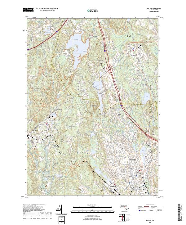
2024 Map of Milford
USGS Topo · Published 2024About this map
Whitehall Reservoir and its surrounding wetlands dominate the northern landscape of this region where Middlesex and Worcester counties meet. The area is characterized by a dense network of water bodies, from the expansive Westboro Reservoir to smaller industrial-era legacies like Fiske Millpond and Craddock Crewes Pond. Development is concentrated along the historic corridors of Hopkinton, Upton, and Milford, which are connected by a mix of modern infrastructure like I-495 and recreational paths such as the Upper Charles Trail.
Find a feature on this map
68 named features on this map. Tap any name to fly to it.
Don’t see what you’re looking for? This feature index may not catch every label — zoom into the map to look around manually.
Map Details
Editions of this 2024 Milford Map
This is the sole edition of this map. No revisions or reprints were ever made.
Other maps of this area

1886 · Blackstone
USGS Topo · 1:62,500

1886 · Framingham
USGS Topo · 1:62,500

1887 · Franklin
USGS Topo · 1:62,500

1887 · Marlboro
USGS Topo · 1:62,500

1889 · Marlboro
USGS Topo · 1:62,500

1889 · Blackstone
USGS Topo · 1:62,500

1889 · Franklin
USGS Topo · 1:62,500

1889 · Framingham
USGS Topo · 1:62,500

1893 · Franklin
USGS Topo · 1:62,500

1893 · Blackstone
USGS Topo · 1:62,500