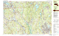
1982 Map of Milford
USGS Topo · Published 1984About this map
The Blackstone River and its industrial corridor dominate the landscape of central Massachusetts in this early 1980s record. The valley is home to a string of historic mill settlements, including Farnumsville, Fisherville, Saundersville, and Wilkinsonville, reflecting the region's long textile manufacturing heritage. To the east, the urban center of Milford is shown in detail, flanked by the residential growth of Hopedale and the older Magomiscock area.
Find a feature on this map
104 named features on this map. Tap any name to fly to it.
Don’t see what you’re looking for? This feature index may not catch every label — zoom into the map to look around manually.
Map Details
Editions of this 1982 Milford Map
This is the sole edition of this map. No revisions or reprints were ever made.
Other maps of this area

1885 · Worcester
USGS Topo · 1:62,500

1886 · Worcester
USGS Topo · 1:62,500

1886 · Blackstone
USGS Topo · 1:62,500

1886 · Framingham
USGS Topo · 1:62,500

1887 · Franklin
USGS Topo · 1:62,500

1887 · Marlboro
USGS Topo · 1:62,500

1889 · Marlboro
USGS Topo · 1:62,500

1889 · Blackstone
USGS Topo · 1:62,500

1889 · Webster
USGS Topo · 1:62,500

1889 · Franklin
USGS Topo · 1:62,500