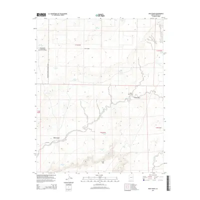
2014 Map of Milky Ranch
USGS Topo · Published 2014About this map
Milky Ranch and the nearby Potter Place anchor this High Desert landscape in eastern Arizona during the early 21st century. The map reveals a specialized ranching infrastructure defined by a network of water catchment systems, including Hashknife Tank, Tamarack Tank, and Middle Wallace Tank, which are essential for managing livestock across the arid terrain. The northwestern corner of the quadrangle is occupied by a section of Petrified Forest National Park, where the land rises toward the prominent Puerco Ridge.
Find a feature on this map
29 named features on this map. Tap any name to fly to it.
Don’t see what you’re looking for? This feature index may not catch every label — zoom into the map to look around manually.
Map Details
Editions of this 2014 Milky Ranch Map
This is the sole edition of this map. No revisions or reprints were ever made.
Other maps of this area

1886 · St Johns
USGS Topo · 1:250,000

1892 · St Johns
USGS Topo · 1:250,000

1912 · Petrified Forest
USGS Topo · 1:62,500

1954 · Saint Johns
USGS Topo · 1:250,000

1955 · Petrified Forest
USGS Topo · 1:62,500

1955 · Adamana 1 SW
USGS Topo · 1:24,000

1955 · Adamana 3 NE
USGS Topo · 1:24,000

1955 · Adamana 4 NE
USGS Topo · 1:24,000

1955 · Adamana 4 NW
USGS Topo · 1:24,000

1955 · Hunt
USGS Topo · 1:62,500