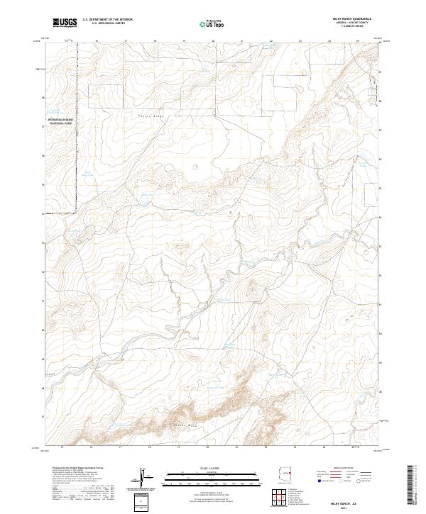
2021 Map of Milky Ranch
USGS Topo · Published 2021About this map
Petrified Forest National Park boundaries extend into this high desert corner of Apache County, defining a landscape of dramatic elevation changes and seasonal watercourses. The northern portion is dominated by the prominent Puerco Ridge, while to the south, the flat-topped Potter Mesa rises above the surrounding plains. This area is characterized by an extensive system of catchment basins or "tanks" used for water management in this arid environment, including Hashknife Tank, Tamarack Tank, and Dead Lake Tank. Drainage is primarily facilitated by the meandering Milky Wash and the deeply incised Potter Place Draw, which together shape the local topography. Local infrastructure is sparse, limited primarily to cattle-rearing features such as Corral Tanks and the winding route of Co RD 5005, reflecting the region's enduring reliance on open-range ranching and land conservation.
Find a feature on this map
28 named features on this map. Tap any name to fly to it.
Don’t see what you’re looking for? This feature index may not catch every label — zoom into the map to look around manually.
Map Details
Editions of this 2021 Milky Ranch Map
This is the sole edition of this map. No revisions or reprints were ever made.
Other maps of this area

1886 · St Johns
USGS Topo · 1:250,000

1892 · St Johns
USGS Topo · 1:250,000

1912 · Petrified Forest
USGS Topo · 1:62,500

1954 · Saint Johns
USGS Topo · 1:250,000

1955 · Petrified Forest
USGS Topo · 1:62,500

1955 · Adamana 1 SW
USGS Topo · 1:24,000

1955 · Adamana 3 NE
USGS Topo · 1:24,000

1955 · Adamana 4 NE
USGS Topo · 1:24,000

1955 · Adamana 4 NW
USGS Topo · 1:24,000

1955 · Hunt
USGS Topo · 1:62,500