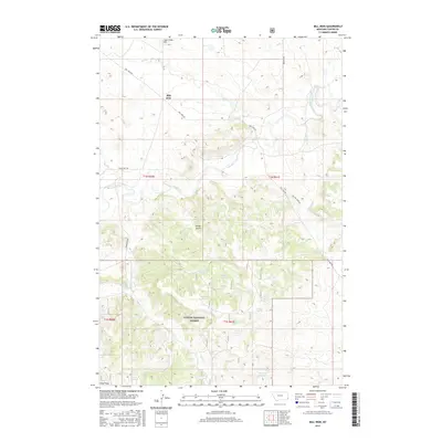
2017 Map of Mill Iron
USGS Topo · Published 2017About this map
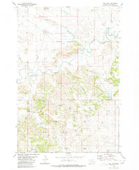
Mill Iron sits at the northern edge of a landscape defined by the drainage networks of southeastern Montana and the northern reaches of the Custer National Forest. This modern 2017 survey reveals an area heavily shaped by water management for ranching and land use, with numerous named water sources including LO Reservoir, Flat Reservoir, and Herman Reservoir scattered across the township lines. The terrain transitions from the high ground of Coal Creek Hill in the north toward the complex drainage of Boxelder Creek and the winding course of Spring Creek. A notable concentration of named springs, such as Red Bluff Spring, Patton Spring, and Arpan Spring, indicates the vital importance of groundwater in this semi-arid region. The infrastructure is characterized by rural thoroughfares like Mill Iron Rd and Old Mill Iron Rd, which follow the natural contours of the land through valleys like Wood Gulch.
Find a feature on this map
27 named features on this map. Tap any name to fly to it.
Don’t see what you’re looking for? This feature index may not catch every label — zoom into the map to look around manually.
Map Details
Editions of this 2017 Mill Iron Map
This is the sole edition of this map. No revisions or reprints were ever made.
Other maps of this area

1954 · Ekalaka
USGS Topo · 1:250,000

1956 · Ekalaka
USGS Topo · 1:250,000

1958 · Ekalaka
USGS Topo · 1:250,000

1965 · Ekalaka
USGS Topo · 1:250,000

1980 · Belltower
USGS Topo · 1:24,000
1980 · Rustler Divide
USGS Topo · 1:24,000

1980 · Dutchmans Hill
USGS Topo · 1:24,000
1980 · Lampkin Gulch
USGS Topo · 1:24,000
1980 · Humbolt Hills
USGS Topo · 1:24,000
1980 · Mill Iron
USGS Topo · 1:24,000