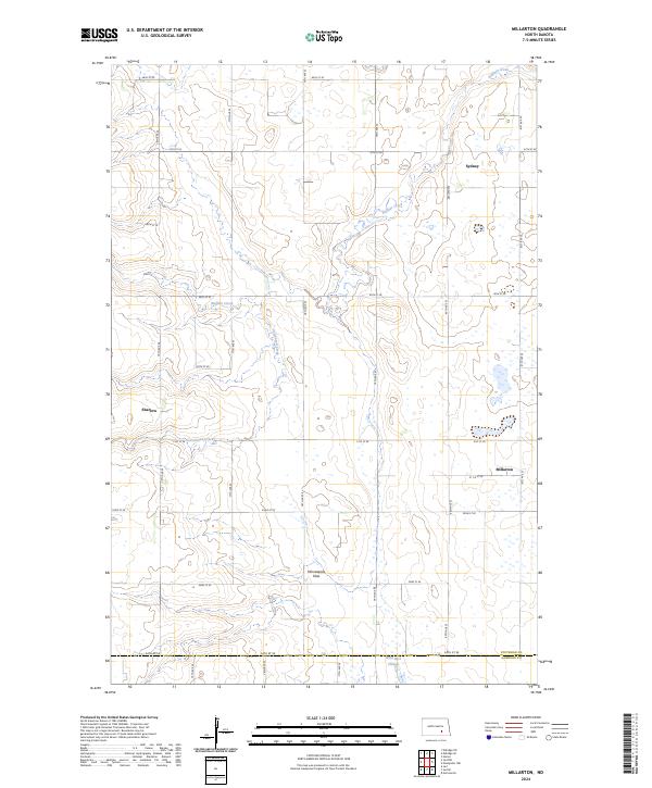
2024 Map of Millarton
USGS Topo · Published 2024About this map
Millarton and Sydney anchor the eastern edge of this agricultural landscape in Stutsman County, where the prairie is deeply etched by a network of drainage systems. Buffalo Creek winds through the northern sections, while Cottontail Creek and Wild Rice Slough define the lower elevations. The expansive Minneapolis Flats occupies the central southern portion of the map, illustrating the flat, fertile glacial terrain characteristic of this region. Settled along a grid of section lines including 54th St SE and 46th St SE, the area maintains the traditional land division patterns of the Great Plains. The small community of Sharlow serves as a western waypoint in a region defined by its wide-open topography and reliance on these vital waterways.
Find a feature on this map
24 named features on this map. Tap any name to fly to it.
Don’t see what you’re looking for? This feature index may not catch every label — zoom into the map to look around manually.
Map Details
Editions of this 2024 Millarton Map
This is the sole edition of this map. No revisions or reprints were ever made.
Other maps of this area

1896 · Jamestown
USGS Topo · 1:125,000

1951 · Eldridge SE
USGS Topo · 1:24,000

1952 · Homer
USGS Topo · 1:24,000

1952 · Jud NW
USGS Topo · 1:24,000

1952 · Eldridge SW
USGS Topo · 1:24,000

1953 · Jamestown
USGS Topo · 1:250,000

1953 · Montpelier NW
USGS Topo · 1:24,000

1953 · Jud
USGS Topo · 1:24,000

1953 · Millarton
USGS Topo · 1:24,000

1953 · Nortonville
USGS Topo · 1:24,000