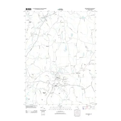
2013 Map of Millbrook
USGS Topo · Published 2013About this map
Stanfordville and the village of Millbrook anchor this survey of the New England-style landscape in central Dutchess County. The area is defined by its agrarian roots, featuring several named agricultural operations including the Hasbrouck Tree Farm, Thunder Hill Farm, and Oak-Leaf Hill Farm. The terrain is characterized by a series of prominent elevations like The Hogback, Round Hill, and Cannon Hills, while the network of water flows toward the E Br Wappinger Cr. Genealogists will find significant value in the documentation of local burial grounds, such as the Nine Partners Cem in South Millbrook and Saint Marys Cem near the northern boundary. Smaller hamlets like Mabbettsville, Shunpike, and Littlerest are clearly delineated along a web of winding roads that follow the natural topography of the hills.
Find a feature on this map
154 named features on this map. Tap any name to fly to it.
Don’t see what you’re looking for? This feature index may not catch every label — zoom into the map to look around manually.
Map Details
Editions of this 2013 Millbrook Map
This is the sole edition of this map. No revisions or reprints were ever made.
Other maps of this area

1893 · Clove
USGS Topo · 1:62,500

1893 · Poughkeepsie
USGS Topo · 1:62,500

1894 · Clove
USGS Topo · 1:62,500

1894 · Poughkeepsie
USGS Topo · 1:62,500

1898 · Clove
USGS Topo · 1:62,500

1898 · Rhinebeck
USGS Topo · 1:62,500

1899 · Millbrook
USGS Topo · 1:62,500

1901 · Clove
USGS Topo · 1:62,500

1902 · Millbrook
USGS Topo · 1:62,500

1903 · Poughkeepsie
USGS Topo · 1:62,500