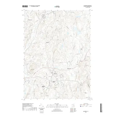
2019 Map of Millbrook
USGS Topo · Published 2019About this map
Millbrook and its surrounding hamlets are defined by a network of historic cemeteries and watercourses in the central Dutchess County countryside. The landscape is dotted with long-established burial grounds, including the Stanfordville Friends Cem and the Nine Partners Cem near South Millbrook, which reflect the area's Quaker roots and early religious history. Numerous small settlements like Bangall, Mabbettsville, and Stanfordville are connected by local routes such as the Sharon Tpke and Shunpike, tracing an older pattern of transport and commerce through the rolling valley.
Find a feature on this map
137 named features on this map. Tap any name to fly to it.
Don’t see what you’re looking for? This feature index may not catch every label — zoom into the map to look around manually.
Map Details
Editions of this 2019 Millbrook Map
This is the sole edition of this map. No revisions or reprints were ever made.
Other maps of this area

1893 · Clove
USGS Topo · 1:62,500

1893 · Poughkeepsie
USGS Topo · 1:62,500

1894 · Clove
USGS Topo · 1:62,500

1894 · Poughkeepsie
USGS Topo · 1:62,500

1898 · Clove
USGS Topo · 1:62,500

1898 · Rhinebeck
USGS Topo · 1:62,500

1899 · Millbrook
USGS Topo · 1:62,500

1901 · Clove
USGS Topo · 1:62,500

1902 · Millbrook
USGS Topo · 1:62,500

1903 · Poughkeepsie
USGS Topo · 1:62,500