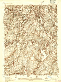
1935 Map of Millbury
USGS Topo · Published 1935About this map
Auburn and Millbury serve as the industrial and residential anchors for this mid-1930s landscape, which is heavily defined by its complex water systems and transport corridors. The Blackstone River and Quinsigamond River cut through the eastern terrain, while the New York New Haven and Hartford RR and the Worcester & Providence Pike demonstrate the area's importance as a regional transit hub. Smaller industrial hamlets like Stoneville, Bramanville, and Pondville appear closely tied to local water resources such as the Stoneville Reservoir and Auburn Pond.
Find a feature on this map
76 named features on this map. Tap any name to fly to it.
Don’t see what you’re looking for? This feature index may not catch every label — zoom into the map to look around manually.
Map Details
Editions of this 1935 Millbury Map
This is the sole edition of this map. No revisions or reprints were ever made.
Other maps of this area

1885 · Worcester
USGS Topo · 1:62,500

1886 · Worcester
USGS Topo · 1:62,500

1886 · Blackstone
USGS Topo · 1:62,500

1887 · Marlboro
USGS Topo · 1:62,500

1889 · Marlboro
USGS Topo · 1:62,500

1889 · Blackstone
USGS Topo · 1:62,500

1889 · Webster
USGS Topo · 1:62,500

1892 · Webster
USGS Topo · 1:62,500

1892 · Worcester
USGS Topo · 1:62,500

1893 · Blackstone
USGS Topo · 1:62,500