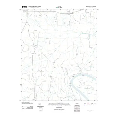
2010 Map of Milledgeville
USGS Topo · Published 2010About this map
The Tennessee River defines the southern portion of this landscape, winding past historic river access points like Coffee Landing, Armstrong Landing, and Bluff Landing. The settlement of Milledgeville anchors the northwest, while the community of Lebanon sits to the northeast, connected by a network of rural roads that cross the multiple waterways feeding into the main river channel. The terrain is notably dissected by various drainage systems, including the Salt River, White Oak Creek, and the Mud Creek Canal, illustrating how water management has shaped the land over time.
Find a feature on this map
92 named features on this map. Tap any name to fly to it.
Don’t see what you’re looking for? This feature index may not catch every label — zoom into the map to look around manually.
Map Details
Editions of this 2010 Milledgeville Map
This is the sole edition of this map. No revisions or reprints were ever made.
Other maps of this area

1936 · Savannah
USGS Topo · 1:24,000

1936 · Hookers Bend
USGS Topo · 1:24,000

1936 · Leapwood
USGS Topo · 1:24,000

1936 · Thurman
USGS Topo · 1:24,000

1936 · Sardis
USGS Topo · 1:24,000

1936 · Milledgeville
USGS Topo · 1:24,000

1936 · Enville
USGS Topo · 1:24,000

1936 · Pittsburg Landing
USGS Topo · 1:24,000

1936 · Stantonville
USGS Topo · 1:24,000

1949 · Hookers Bend
USGS Topo · 1:24,000