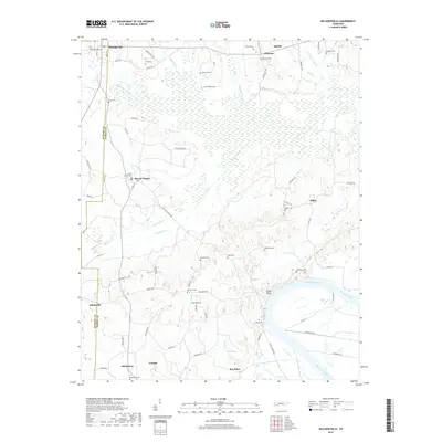
2019 Map of Milledgeville
USGS Topo · Published 2019About this map
The Tennessee River and Kentucky Lake dominate the eastern landscape of this region along the border of McNairy and Hardin Counties. The terrain is defined by a dense network of managed waterways, including the White Oak Cr Canal, Hurricane Cr Canal, and Mud Cr Canal, which suggest a long history of land reclamation and agricultural management in the low-lying bottoms. Small settlements like Morris Chapel, Milledgeville, and Sibley are scattered throughout the upland areas, connected by rural routes such as Coffee Landing Road. Genealogists will find a high density of family and community burial sites, from Bethlehem Cemetery in the south to Pickens Cemetery near Saltillo in the north. Notable geographic landmarks like Chalk Bluff overlook the river, marking a distinct transition between the alluvial plains and the rising ridges of West Tennessee.
Find a feature on this map
79 named features on this map. Tap any name to fly to it.
Don’t see what you’re looking for? This feature index may not catch every label — zoom into the map to look around manually.
Map Details
Editions of this 2019 Milledgeville Map
This is the sole edition of this map. No revisions or reprints were ever made.
Other maps of this area

1936 · Savannah
USGS Topo · 1:24,000

1936 · Hookers Bend
USGS Topo · 1:24,000

1936 · Leapwood
USGS Topo · 1:24,000

1936 · Thurman
USGS Topo · 1:24,000

1936 · Sardis
USGS Topo · 1:24,000

1936 · Milledgeville
USGS Topo · 1:24,000

1936 · Enville
USGS Topo · 1:24,000

1936 · Pittsburg Landing
USGS Topo · 1:24,000

1936 · Stantonville
USGS Topo · 1:24,000

1949 · Hookers Bend
USGS Topo · 1:24,000