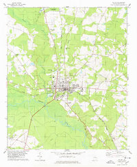
1978 Map of Millen
USGS Topo · Published 1978About this map
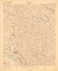
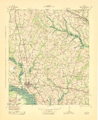
The city of Millen serves as the focal point of this late 1970s survey, situated at the crossroads of the Central of Georgia railroad and the Ogeechee River. The landscape is defined by the convergence of several waterways, including Buckhead Creek and Little Buckhead Creek, which flow through the forested lowlands surrounding the town center. To the north, Magnolia Springs State Park and the adjacent Magnolia Springs Country Club mark a significant recreational area, while Lincoln State Park sits just west of the city limits.
Find a feature on this map
34 named features on this map. Tap any name to fly to it.
Don’t see what you’re looking for? This feature index may not catch every label — zoom into the map to look around manually.
Map Details
Editions of this 1978 Millen Map
This is the sole edition of this map. No revisions or reprints were ever made.
Historical Maps of Millen Through Time
9 maps found