
1920 Map of Millen
USGS Topo · Published 1920About this map
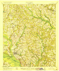
The Ogeechee River defines the southern boundary of this 1920 survey, where the junction of the Central of Georgia and Savannah and Georgia railroads turned Millen into a vital regional hub. This era of settlement is characterized by a dense network of country schools and churches that served as the social backbone for rural Jenkins County, including Walker Academy, Little Buckhead School, and Old McCoy Church. The presence of Old Fort Lawton near Magnolia Spring marks a site of significant local history, while the transition from Old Sardis to the newer settlement of Sardis to the northeast illustrates the shifting centers of commerce. Navigating the landscape via the Louisville and Savannah Road, one finds a tapestry of family-named landmarks like Jackson Pond and Braggs Mill along the many creek branches feeding the Ogeechee.
Find a feature on this map
61 named features on this map. Tap any name to fly to it.
Don’t see what you’re looking for? This feature index may not catch every label — zoom into the map to look around manually.
Map Details
Editions of this 1920 Millen Map
2 editions found
Other maps of this area

1918 · Oliver
USGS Topo · 1:62,500

1919 · Gough
USGS Topo · 1:62,500

1920 · Ellenton
USGS Topo · 1:48,000

1920 · Hilltonia
USGS Topo · 1:62,500

1920 · Greens Cut
USGS Topo · 1:62,500

1920 · Oliver
USGS Topo · 1:62,500

1921 · Rocky Ford
USGS Topo · 1:62,500

1921 · Ellenton
USGS Topo · 1:62,500

1943 · Hilltonia
USGS Topo · 1:62,500

1943 · Greens Cut
USGS Topo · 1:62,500