
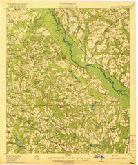
1921 Map of Rocky Ford
USGS Topo · Published 1921About this map
The Ogeechee River carves a wide, swampy course through this 1921 portrait of rural Georgia, defining the borders of Jenkins, Screven, Bulloch, and Candler counties. The landscape is dotted with small-scale agriculture and industry, evidenced by Mallards Mill and DeLoach Mill situated along the many creek branches. The Central of Georgia Railroad serves as a primary transit artery, connecting the community at Rocky Ford with smaller stops like Scarboro and Ogeechee.
Find a feature on this map
88 named features on this map. Tap any name to fly to it.
Don’t see what you’re looking for? This feature index may not catch every label — zoom into the map to look around manually.
Map Details
Editions of this 1921 Rocky Ford Map
2 editions found
Other maps of this area

1918 · Oliver
USGS Topo · 1:62,500

1920 · Statesboro
USGS Topo · 1:62,500

1920 · Hilltonia
USGS Topo · 1:62,500

1920 · Millen
USGS Topo · 1:62,500

1920 · Oliver
USGS Topo · 1:62,500

1921 · Brooklet
USGS Topo · 1:62,500

1943 · Brooklet
USGS Topo · 1:62,500

1943 · Hilltonia
USGS Topo · 1:62,500

1943 · Rocky Ford
USGS Topo · 1:62,500

1943 · Millen
USGS Topo · 1:62,500