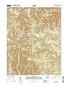
2016 Map of Millers Tavern
USGS Topo · Published 2016About this map
Dragon Swamp and Exol Swamp define the low-lying hydrology of this coastal plain landscape along the border of Essex and King and Queen counties. This 2016 survey illustrates a largely rural corridor anchored by crossroads settlements such as Millers Tavern and Pauls Crossroads. Local history and genealogy are anchored by landmarks like Smyrna Cem and the village of Bruington, while the industrial and agricultural past is reflected in family-named features like Wrights Millpond and Dickeys Hill. The area's transport network is characterized by historic routes like Howerton Rd and Lumbee Indian Rd, which wind through the wetlands of Dragon Run. Modern infrastructure, including the Tappahannock-Essex County Airport, sits adjacent to older communities like Howertons and Bestland, showing the gradual evolution of this Tidewater region.
Find a feature on this map
75 named features on this map. Tap any name to fly to it.
Don’t see what you’re looking for? This feature index may not catch every label — zoom into the map to look around manually.
Map Details
Editions of this 2016 Millers Tavern Map
This is the sole edition of this map. No revisions or reprints were ever made.
Other maps of this area

1918 · Tappahannock
USGS Topo · 1:62,500

1918 · Aylett
USGS Topo · 1:62,500

1919 · New Kent
USGS Topo · 1:62,500

1919 · Tappahannock
USGS Topo · 1:62,500

1920 · King William
USGS Topo · 1:62,500

1933 · Aylett
USGS Topo · 1:62,500

1943 · Richmond
USGS Topo · 1:250,000

1944 · Mount Landing
USGS Topo · 1:31,680

1944 · Tappahannock
USGS Topo · 1:31,680

1944 · Dunnsville
USGS Topo · 1:31,680