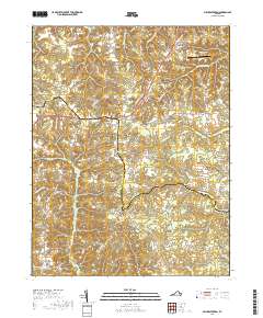
2019 Map of Millers Tavern
USGS Topo · Published 2019About this map
Millers Tavern sits at a critical junction of local commerce and transit in this landscape where the boundaries of King and Queen and Essex counties meet. The area is defined by a dense network of watercourses and wetlands, including the extensive Dragon Swamp and Exol Swamp, which historically dictated the placement of settlements and crossings. Local centers of life like Powcan, Bruington, and Daisy are connected by narrow roads that often trace the higher ground between these drainages. Genealogists and historians will find interest in the proximity of Smyrna Christian Church and its associated Cemetery, alongside landmarks like Weights Millpond and Dickeys Hill. The map also captures the modern footprint of the Tappahannock-Essex County Airport and various river crossings, such as the Covington Bridge over Dragon Run, which illustrate the enduring importance of these corridors in rural Virginia.
Find a feature on this map
72 named features on this map. Tap any name to fly to it.
Don’t see what you’re looking for? This feature index may not catch every label — zoom into the map to look around manually.
Map Details
Editions of this 2019 Millers Tavern Map
This is the sole edition of this map. No revisions or reprints were ever made.
Other maps of this area

1918 · Tappahannock
USGS Topo · 1:62,500

1918 · Aylett
USGS Topo · 1:62,500

1919 · New Kent
USGS Topo · 1:62,500

1919 · Tappahannock
USGS Topo · 1:62,500

1920 · King William
USGS Topo · 1:62,500

1933 · Aylett
USGS Topo · 1:62,500

1943 · Richmond
USGS Topo · 1:250,000

1944 · Mount Landing
USGS Topo · 1:31,680

1944 · Tappahannock
USGS Topo · 1:31,680

1944 · Dunnsville
USGS Topo · 1:31,680